


Welcome back to another look at The City with Cedric Richards, where you can expect a look at the Forest City with a fresh perspective. Thank you to all of you who have chosen The Loon in reading and subscribing to us each day.
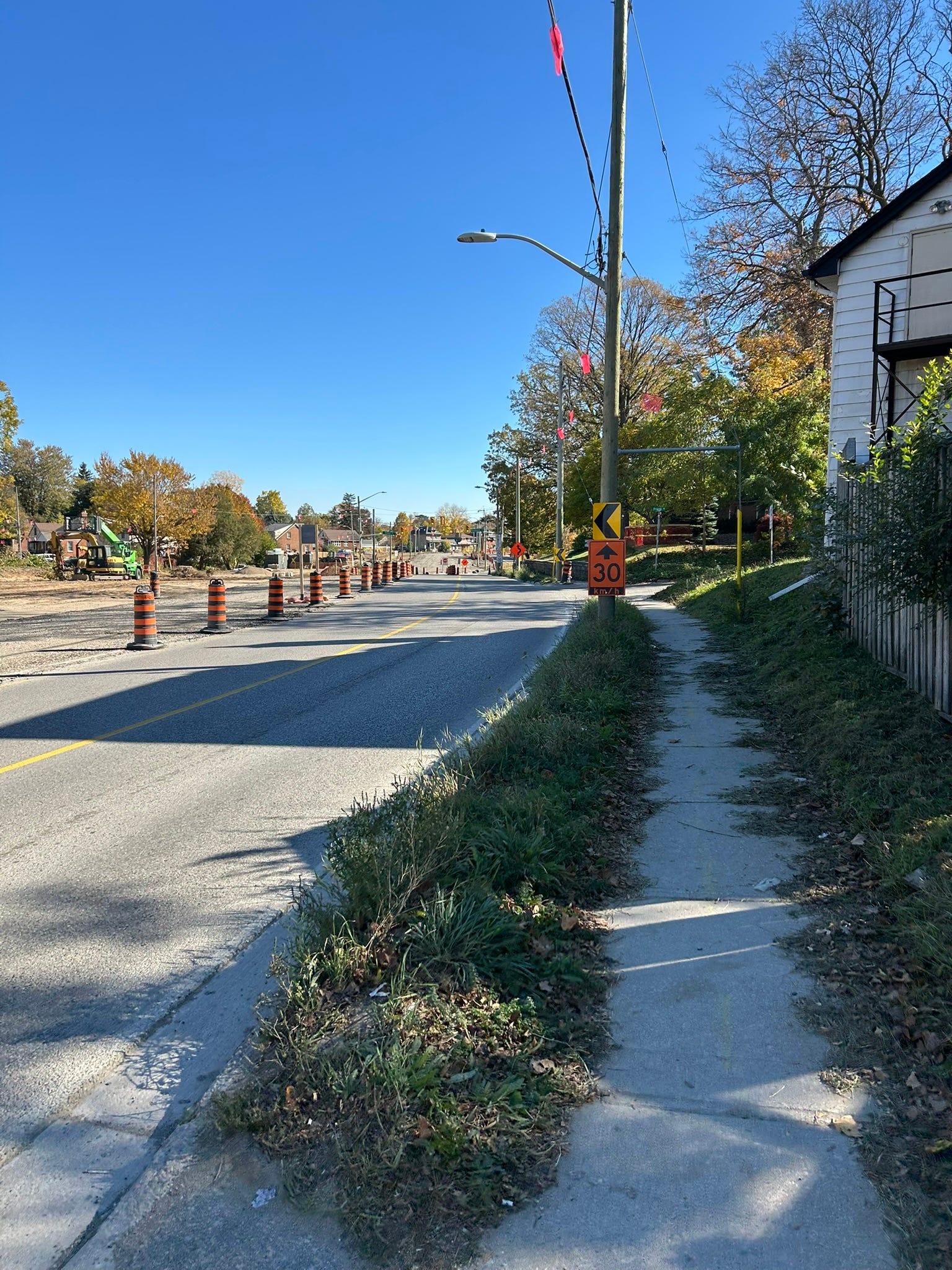
Let’s journey this week to Wellington Road, just south of the Thames River. You don’t think much about arterial roads other than driving on them. Roads like these often don’t have much of an identity, and are just perceived as lines on a map. Merely lines that you drive on. When I was profiling the wards of London, it was quite a struggle to describe a lot of arterial roads because they bounded neighborhoods, districts, constituencies, and wards. On the other side of the road is a completely different community, and an alien vibe.
Wellington Road is the primary artery that connects the downtown core with Highway 401. Starting at the Thames River as a southerly continuation of Wellington Street, Wellington cuts through the oldest parts of South London, turning sharply around Bond Street in the Rowntree area. Prior to the ongoing construction projects in the south end, Wellington Road’s width varied from four to six lanes, south of Base Line Road. South of Dingman Drive, the road narrows to two lanes, dividing London’s rural expanse into two. The etymology, what Wellington is named after, comes from Arthur Wellesley, 1st Duke of Wellington. He was a longtime British Army officer and commander-in-chief, serving as the Prime Minister of the United Kingdom on two occasions. His historical status as a war hero has extended to many places, towns, and streets in the UK and Canada, and elsewhere bearing the name Wellington. Squaring the etymology with the evolution of this corridor is quite the feat.
I would like to think that Wellington Road in London is starting to forge an identity for itself. Maybe this is the opening Wellington needs, especially its curve. Currently what is known as Phase 2B of the Wellington Gateway bus rapid transit is underway as a construction project. When the entire Wellington gateway is completed, buses will run between White Oaks Mall and the downtown core on average every five minutes, together with a new multi use pathway that will make walking and cycling and rolling more accessible for people using the road. And within the scope of this column, The curve that makes up Wellington Road just south of the river, will be smoothed out, improving safety for all users of the road.
South of the Thames
Let’s talk about the area around that curve, starting at the Thames River, and let’s walk southbound. Wellington Road begins at the Thames River, as a southerly extension of Wellington Street. There is little of a change between the two Wellingtons, and with little hint of the suburban concrete conurbation that will dominate south London just a few kilometres away.
The notorious multi-use pathway known as the Thames Valley Parkway branches off to the east. The section that runs between Wellington Road and Adelaide Street North is subtitled the Jane Bigelow Pathway. Bigelow was London’s first woman mayor serving from 1972 to 1978, and was an avid cyclist; the commemoration was granted by city council at the request of Bigelow’s children.
The first intersection immediately south of the river is where Front Street branches off in the west, and Kennon Place branches off to the east. Front Street had more of a prominence in London’s geography many decades ago, but the tragic flood of 1937 relegated it to just a cul-de-sac with a few houses. Kennon Place is one of the few streets in London where odd and even address numbers sit side by side.
South London has a bit of a Frankenstein-style road network, where in living memory the road network was more disjointed than the current day. Compare it to old road maps, and you’ll see a stark difference. Wellington Road and Base Line Road are prime examples of that.
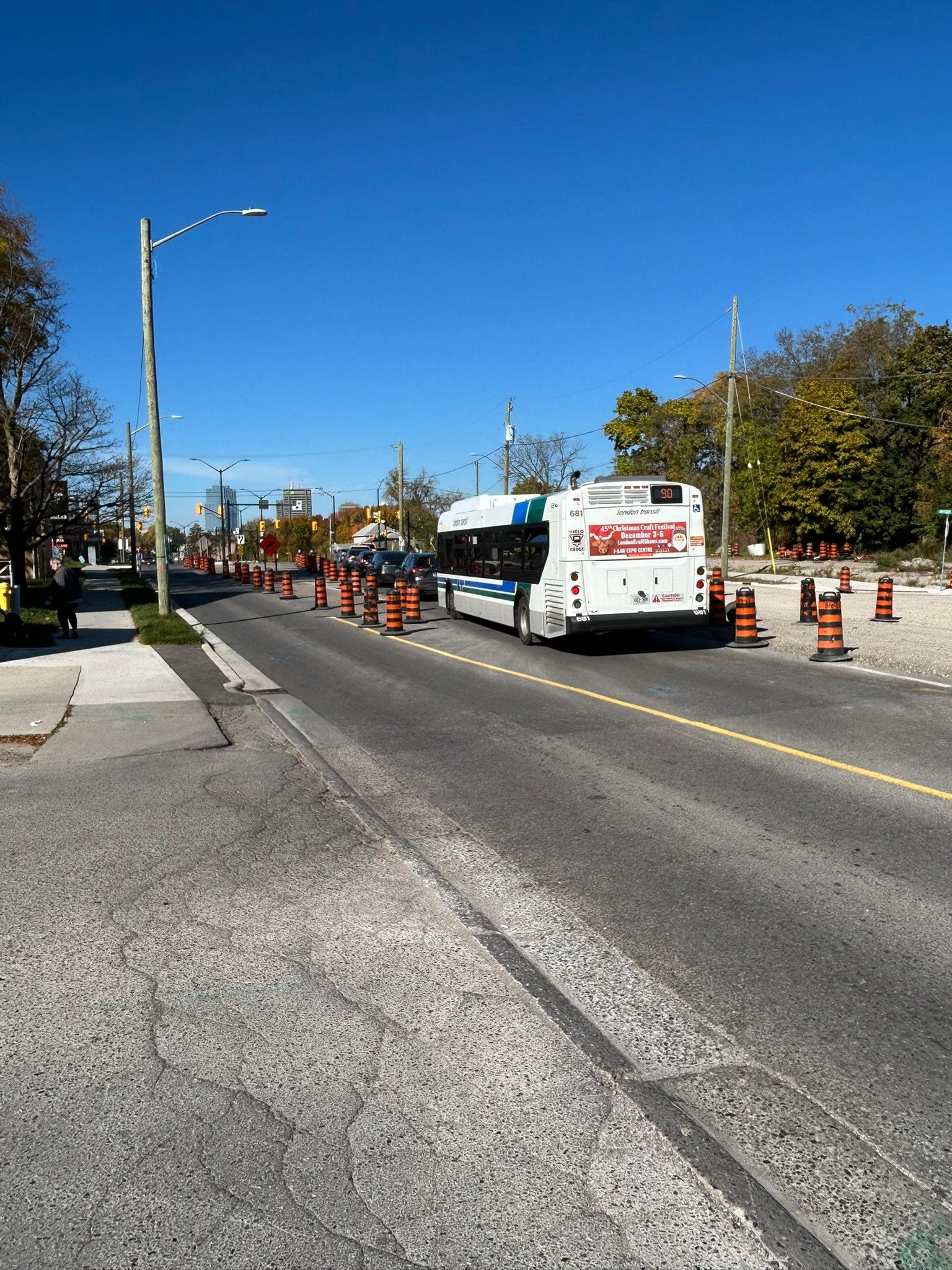
Around the intersection of Grand Avenue are a few apartment buildings, an LCBO, and a Pizza Hut. Here there are parking lots in which you can access either Wellington Road or High Street in a matter of seconds. This leads to the unintended consequence of cars using it as cut-through traffic. I have unfortunately seen many a pickup truck use the Pizza Hut parking lot to try to access Wellington Road. This part of Wellington was also the site of a planning application that would have seen two high rises containing a combined total of about 1,000 units. The vast majority of them were proposed to be small apartment units. When the proposal was first shared on social media, the community surrounding it had cried foul. Many people raised concerns about spillover parking, traffic, and the livability of these prospective units. The Planning and Environment Committee unanimously rejected the application, which was ratified by a full City Council last month. I can only wonder, what would Wellington look like had it been built?
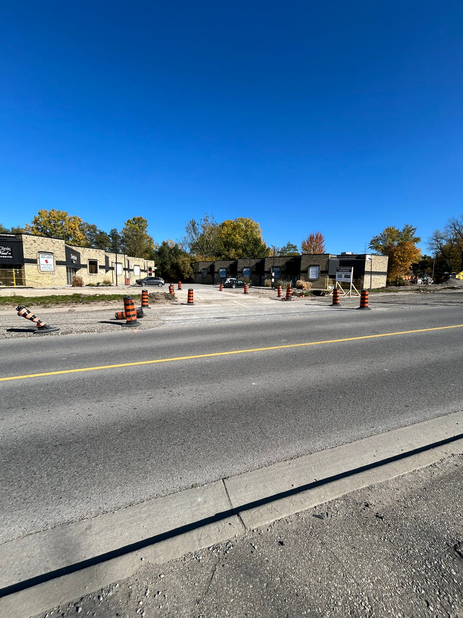
Just south of Watson Street, is a pair of commercial plaza buildings, which back out onto parkland. From a satellite view, they look like Lego blocks that interlock with each other. Further south of that, approaching the corner with Weston Street, are the former sites of Curry’s Restaurant, and a+Link Architecture. Curry’s raised some outrage with the expropriation of their own property and eventual closure. While many Londoners lamented the closing of a restaurant where they first tasted Indian food, the restaurant itself described the expropriation as “being hit by the bus”. I personally lamented the demolition of a+Link Architecture, because it had such a wonderful exterior, which garnered the firm a recognition at a past Urban Design Awards event from the City of London.
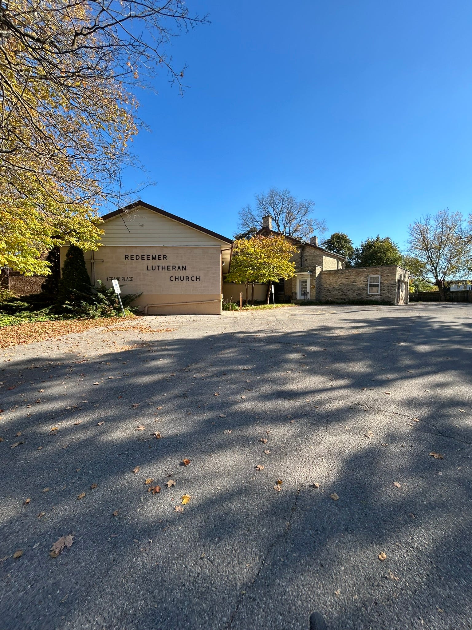
Opposite Weston Street, Wellington climbs a hill to meet the Redeemer Lutheran Church, a three-headed building of a church that first opened in 1954. In light of all the construction going on, this is where I attended a public consultation for what is now the Wellington Gateway about eight and a half years ago.
The curve
Where the grade decreases in Wellington, the road starts to abruptly straighten out. There are a few weird intersections that meet up with Wellington. On the west side, you have one of London’s earliest curvilinear street networks, and you can tell where the streets were straightened out to deal with the Wellington Road of it all. Frank Place, Windsor Crescent, Wellington Crescent and Foxbar Road arch and bend to form grassy islands as well as Gartshore Park, which fronts onto Wellington Road. Some neighbours have taken to calling the area “The Foxy Frindsor” and organizing street parties where a block is closed to traffic (but open to the community).
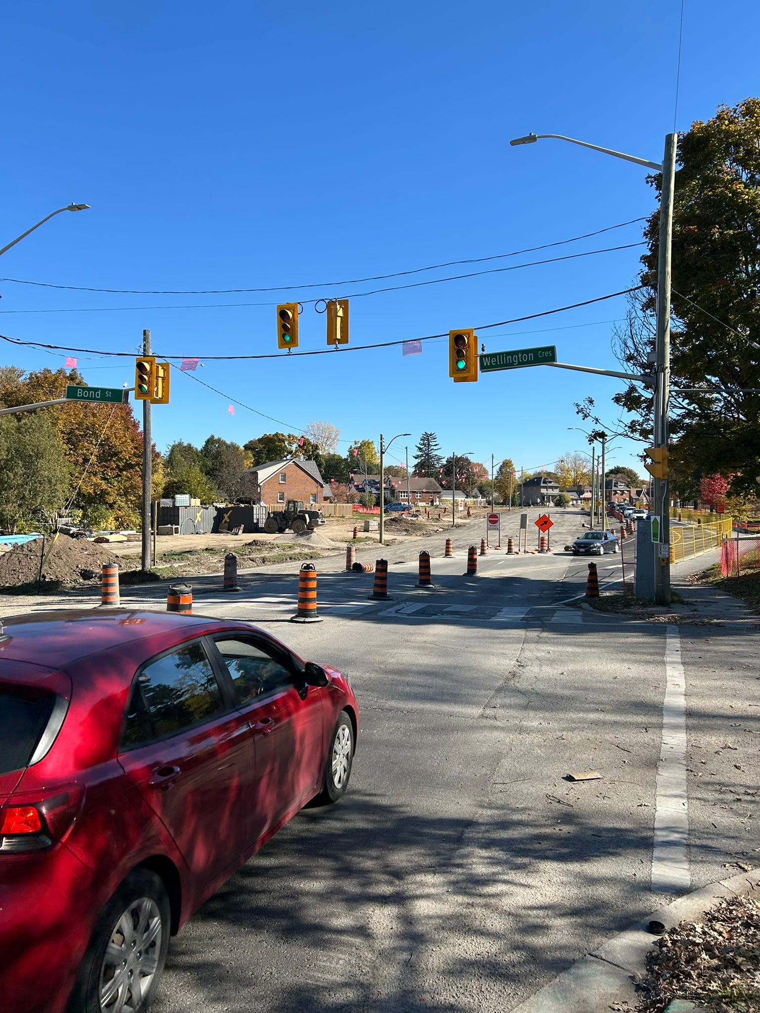
In 2018, a crosswalk was added around here, finally connecting Bond Street with Wellington Crescent. This will later be turned into a full intersection during construction.
Where Wellington Road fully straightens out is the intersection with Foxbar Road. This is where the St. Andrews Memorial Church has resided since 1941, first being erected the year that Martha Stewart was born. As the saying goes, history is recent. About two years ago, a demolition request in tandem with the revocation of its heritage status was granted for this church. Per the church, they continue to operate for the foreseeable future.
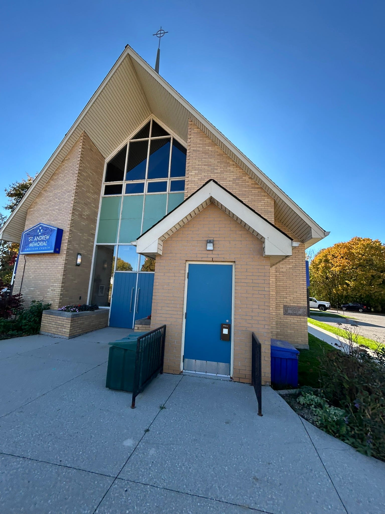
Piece by piece, over the last number of years, properties have been acquired and demolished by the city. You can see all of the holes along the way, and check out Google Street View to see what there once was.
South of Alexandra Street, many houses and businesses remain intact. One of the houses along Wellington Road was the lifelong residence of notable poet and writer Roy McDonald. As such, he spent a lot of time in this immediate area, including working at the former A&P grocery store further south near Base Line Road East. He makes a few observations about the area in an intensive journaling work known as Living: A London Journal.
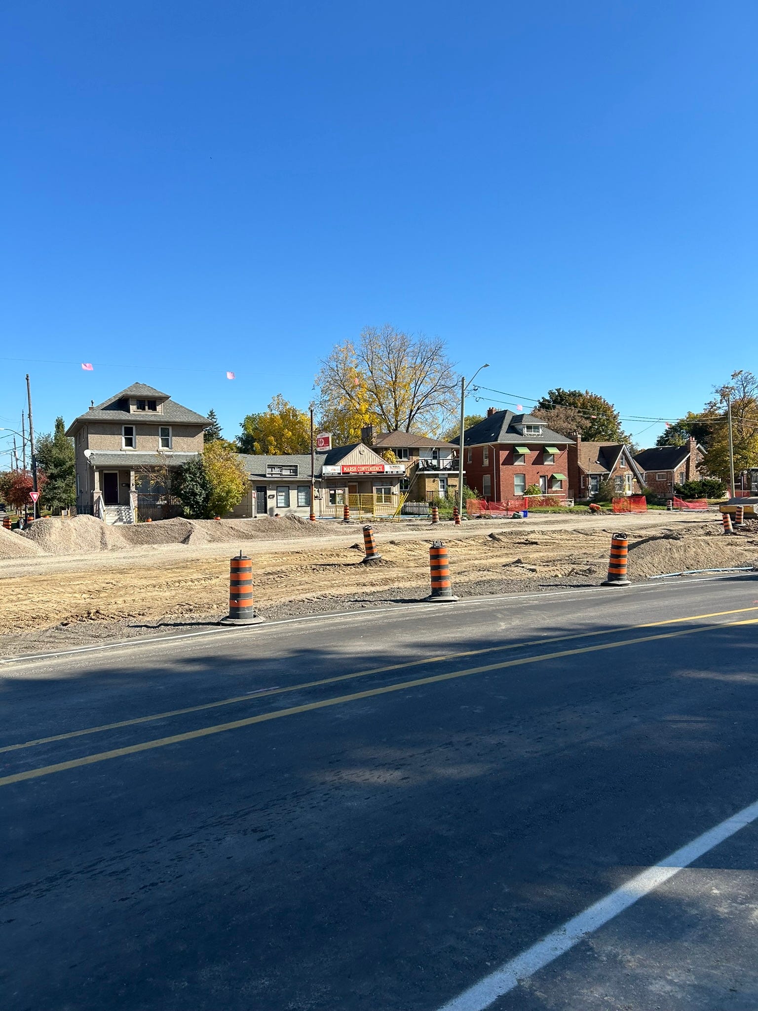
Around Base Line Road East begins a different kind of Wellington Road. The next few intersections lead to hospitals, alongside many healthcare-oriented institutions, doctor’s offices, among other facilities. There are also many plazas and large-format stores. There may be some high-rises in the future; planning applications have been submitted to the city for a tower on the southeast corner of Wellington and Base Line. Wellington Gate, formerly known as Westminster Centre, has reimagined their plaza for a mixed-use future, with plans to construct a high-rise on the site of the former Beer Store.
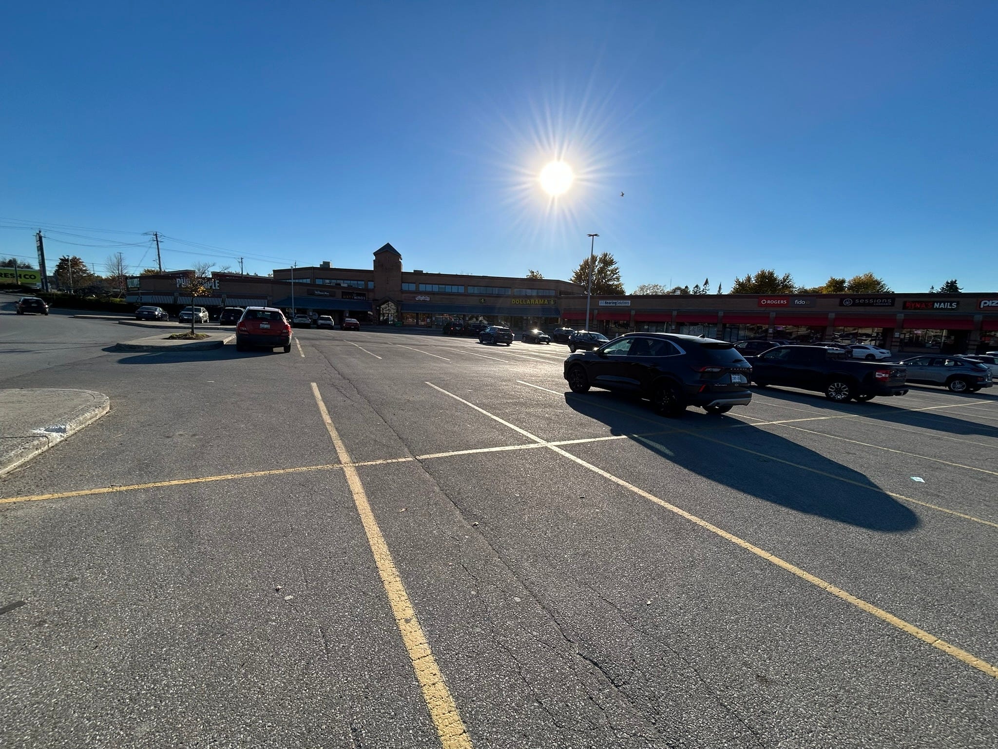
On the other side of Wellington, another plaza, formerly known as Victoria Place, sits at the corner of Wellington and Commissioners. The clock that sits atop the office portion of the plaza, is one of those little things that I appreciate in designs in our built environment. It was never well-advised to turn left to exit the plaza, and the Wellington Gateway project will be putting an end to that.
What now
Construction has barely started on this section of Wellington, and it has not been easy on many people and the businesses they own. There was a complex of two buildings on the corner of Wellington Road and Wellington Court. The buildings, or complex, where I had my hair cut for the last several years, fell to the expropriation spree. The barbers shared their grievances on social media, anxiously awaiting construction and municipal vehicles to leave their space. They have since moved their shops north to within a few blocks of the Adelaide Street underpass, a spot ironically known for construction that snarled traffic for a few years.
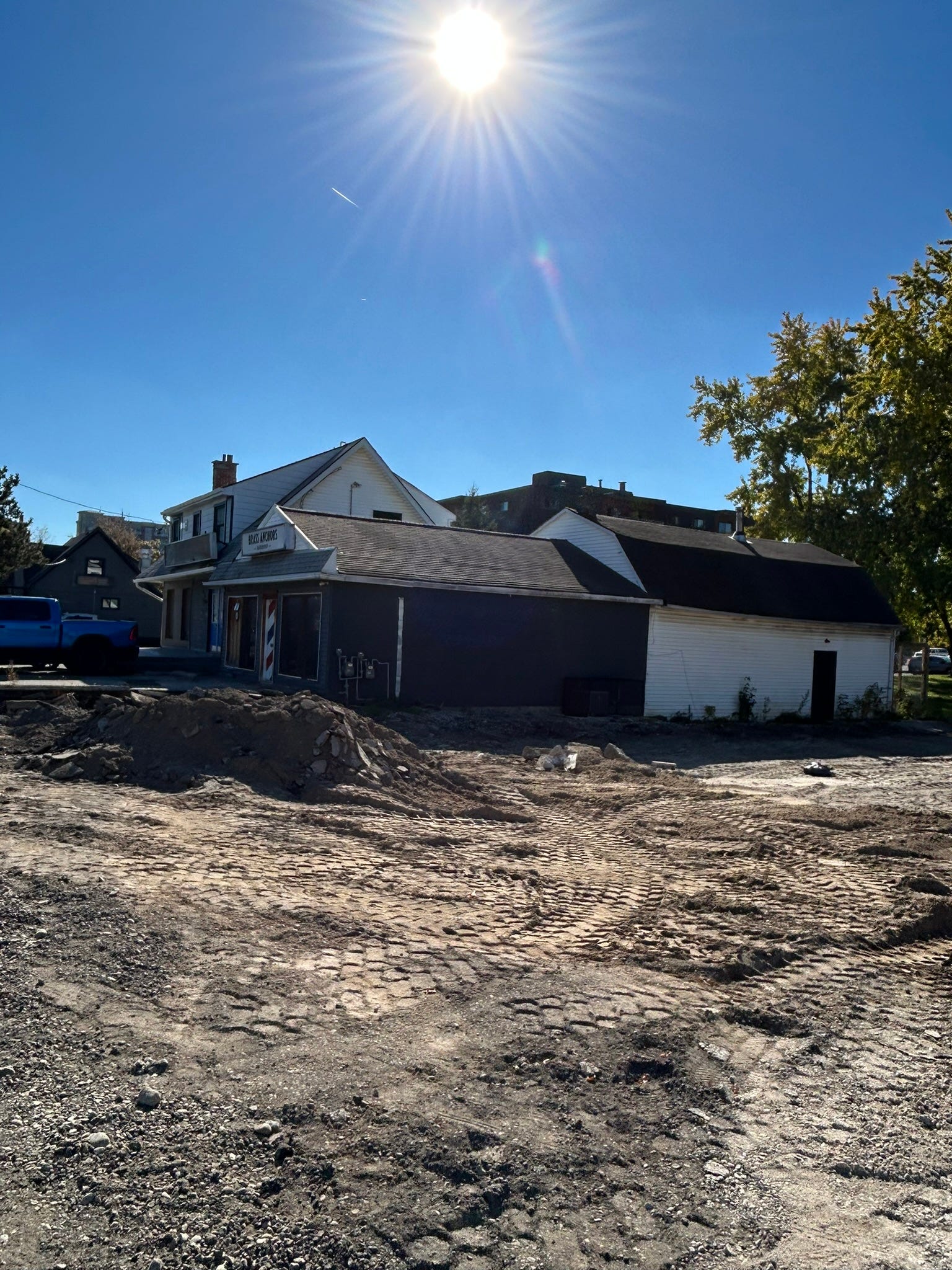
For now, a temporary, two-lane road has been constructed that runs between Wellington Crescent and Thomas Janes Drive. This arrangement is not new to construction projects in the city; the Adelaide Underpass also featured a temporary road while the trench was constructed. There is a multi-use path that runs concurrently with the temporary Wellington Road, where a fence separates the two.
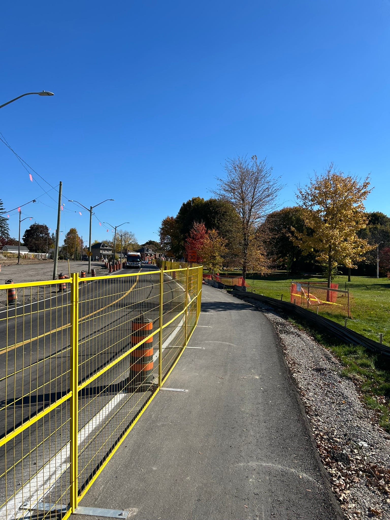
Phase 2B combined with the other portion, Phase 2A, (focusing on Wellington near the hospitals) will see construction finalized in about three and a half years from now. It seems like a long way from now, but fixing up this road was long overdue. Every pedestrian, transit rider, cyclist, and driver knows it. Driving along all the peaks and valleys of the asphalt alone was a nightmare. Is it four or six lanes? Hard to say when the paint dividing the lanes vanishes for a bit. Cyclists usually have to default to Ridout Street to get to the south end; imagine if you had to bypass the road you needed to be on for several kilometres in order to secure your own safety? As a pedestrian, drivers do not see you cross Wellington Rd. It’s like pedestrians are ants from the view of a windshield. And bus riders should not be waiting more than 15 minutes for a bus on an important corridor like this one.
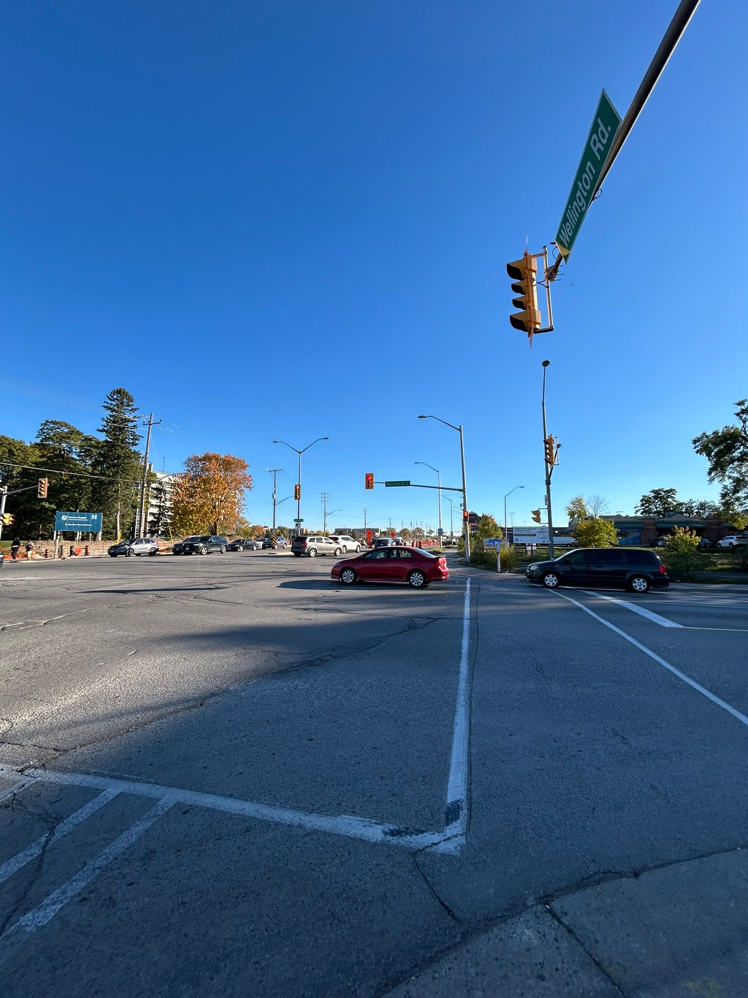
I hope you enjoyed our time together today, where we walked along a key stretch of Wellington Road, the artery of a new South London. I also hope you learned a bit about how it affects your commute in the years to come and when it is complete.
Check back each Tuesday for my take on experiencing London from a fresh perspective. I am excited to bike around the city and report back to you. I welcome comments, suggestions, and topics to discuss each Tuesday. Please subscribe and let’s talk soon!
The Loon (London Ontario Online News) lineup
Local independent journalism bringing you new content every day.
Find our editorial standards and policies here.

Meet the Londoners who team up to send you a new feature every weekday:
Monday - Buckle Up - podcast with Matt Brown
SPONSORED BY HAMILTON ROAD BIATuesday - City Tours with Cedric Richards
SPONSORED BY LONDON BICYCLE CAFÉWednesday - City Hall Notes by Mike Donachie
SPONSORED BY SPERO LAWThursday - the Forest City Arts and Culture Roundup by Diana Tamblyn
SPONSORED BY DOWNTOWN LONDONFriday - Reflections with Steve Cordes
SPONSORED BY OLD EAST VILLAGE BIA
Also on Fridays: the local news ROUNDUP.
Every other Saturday: The Matt Brown Podcast. It’s the show about all things local, and maybe some other stuff too. SPONSORSHIP OPPORTUNITY AVAILABLE.